Town, Region, or Site-Based Landscape Interpretation
I research and create landscape interpretations for specific sites, towns or regions. Through presentations, field trips, or written reports, I help local people understand natural and cultural features on their landscape and why they are where they are.
Sample projects:
- Field-based instruction on understanding the local cultural landscape and how it interacts with the natural landscape for the Vermont Master Naturalist Program. Completed programs in: Richmond, Burlington, the Bristol 5 Towns area, South Hero, Hinesburg, South Burlington, Burlington, Middlebury Area, Charlotte, Cambridge, and Muddy Brook Region, September 2018 – April 2023.
- An illustrated presentation called The Evolution of Enosburgh’s Cultural Landscape for Cold Hollow to Canada, September 2022.
- Programs to assist UVM graduate and undergraduate students in their interpretation of conservation sites in Huntington, Williston, Hinesburg, and Georgia, for spring semester courses in 2021-2023.
- An illustrated presentation called Humans and the Environment in Burlington Through Time for Burlington Geographic in December 2019. Other presenters included Christine Vatovec from UVM on how environmental health and human health intersect, Dan Quinlan, the chair of the Vermont Climate and Health Alliance, and Walter Poleman, the founding director of the PLACE Program. To view this talk, go to: ttps://www.retn.org/show/human-health-and-environment-burlington-through-time and/or https://vimeo.com/379815234.
 Landscape History Site Interpretation and Resources of the Twin Hills Girl Scout Camp. This project supports the Scouts new year-round program development initiative that will use site-specific resources. Spring and summer 2019.
- A community presentation sponsored by the Huntington Historical and Community Trust called The Evolving Cultural and Natural Landscape of Huntington, October 2019.
- Introduction to the Evolution of Richmond’s Cultural Landscape. Kick-off presentation for the Vermont Master Naturalist Program in Richmond, August 2018, and for the Richmond Historical Society’s Annual Meeting, February 2019.
- Interpreting Castleton Village Landscapes with Old Maps. Vermont Geographic Alliance Summer Institute, July 2010.
- Nulhegan River Watershed Research Project for the Vermont River Conservancy. I researched and wrote a report on the cultural resources and landscape history of the Nulhegan River watershed to inform the Conservancy’s decision-making about the placement of new riverside camp sites for the Northern Forest Canoe Trail. Spring and Summer, 2009.
Public Speaking and Field Trips
I do public speaking and lead field trips on topics such as:
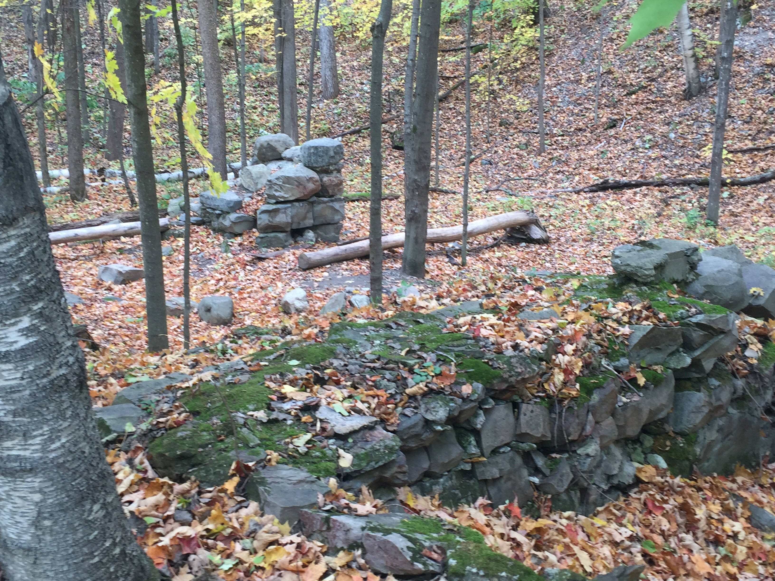
- Interpreting the Stone Wall Landscape of Vermont
- Using LiDAR to Find and Interpret 19th-Century Landscape Features
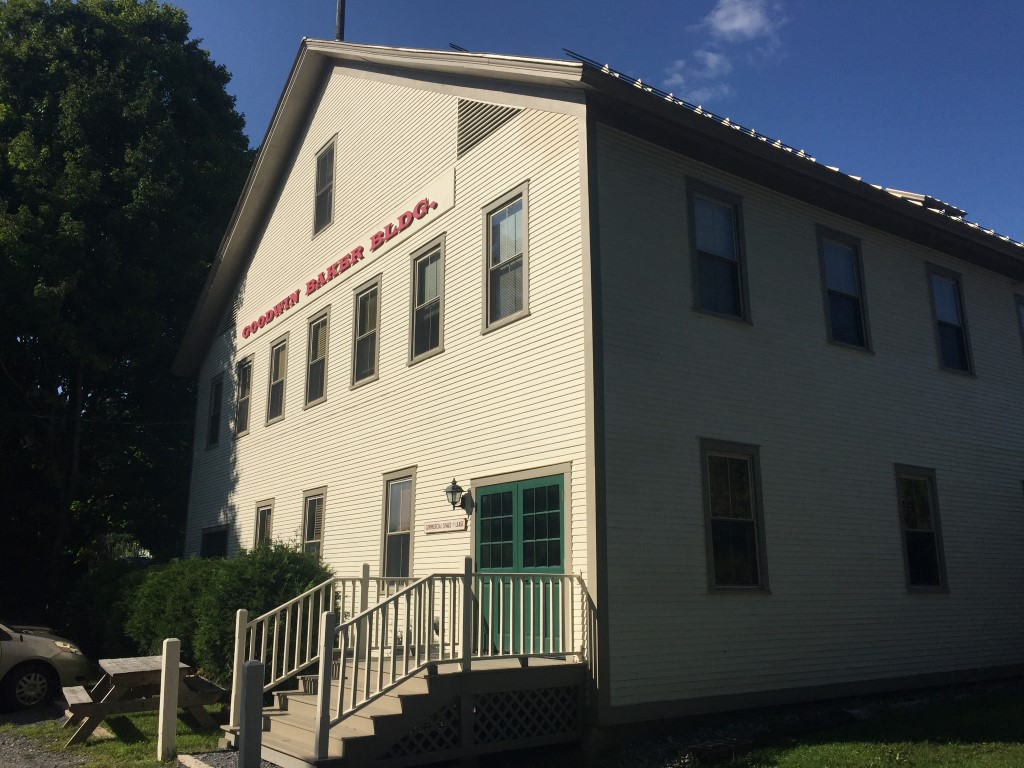
- Interpreting Vermont’s Mill Villages with Old Maps
- Understanding the Evolution of Vermont’s Center Villages
Contact me about other topics of interest to you and your community.
Tours and Map Products
I research, design, and create tours and maps that interpret the landscape history of a local area to help visitors gain deeper understandings of what they see around them.
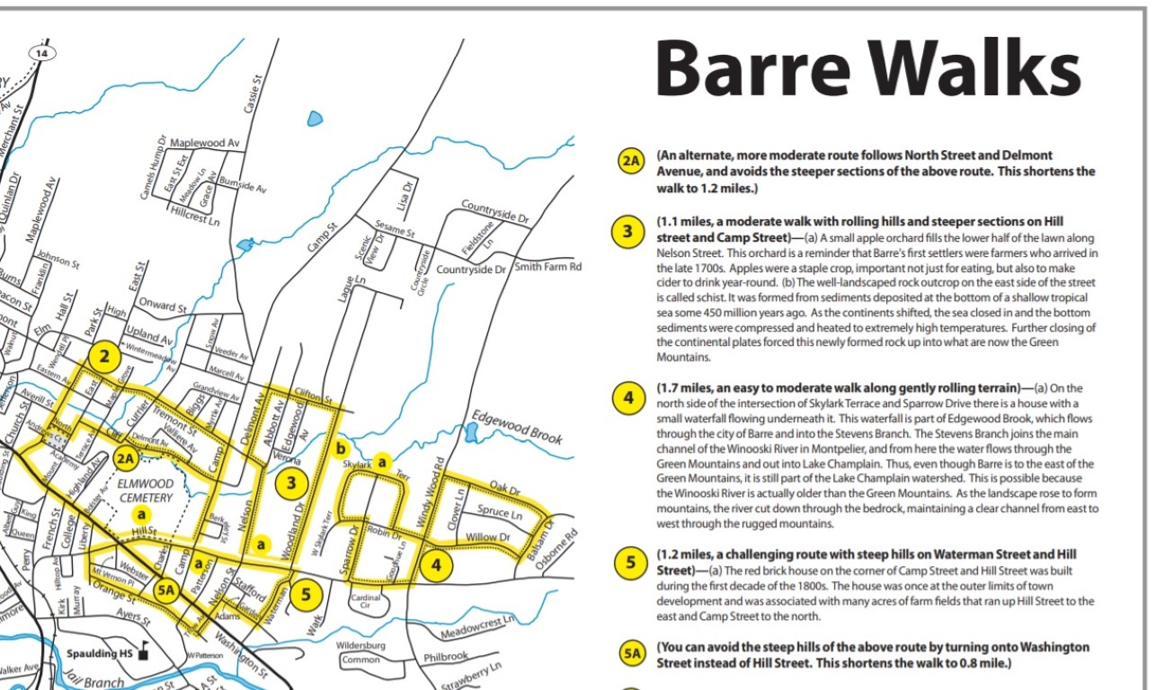
- Walking maps of Vermont cities for Blue Cross Blue Shield of Vermont, including Montpelier, Barre, and Burlington. Link: https://secure.bcbsvt.com/walking-supplies.php
- Landscape Tour of the Ethan Allen Homestead Property. The tour walks visitors through the larger landscape surrounding the Allen home. Over the course of the tour, visitors travel back through time, starting with features that arrived recently and working back to those that arrived during geologic time. Ethan Allen Homestead Museum in Burlington.
Place-Based Education
I design and deliver place-based education experiences for school children and teachers. Using the local landscape around the school, I can create lessons or units with hands-on activities that help children understand and connect to what is in their immediate environment. Topics can include reading the patterns of the bedrock geology, glacial history, plant and animal communities, and Native American and European settlers use of the Vermont landscape.
Age-appropriate activities can include:
- finding landscape features that illustrate the local stages of geologic formation and modeling them,
- analyzing and comparing sediments from different parts of the study area to understand how and why they were formed,
- exploring glacial lake and saltwater beach areas to understand human interactions with ancient environments,
- measuring and analyzing plant and animal communities, including citizen science project participation
- recognizing and studying remnant features from an earlier settlement era, like the old farmhouse surrounded by an urban neighborhood, or the old grist mill site on the waterfall in town,
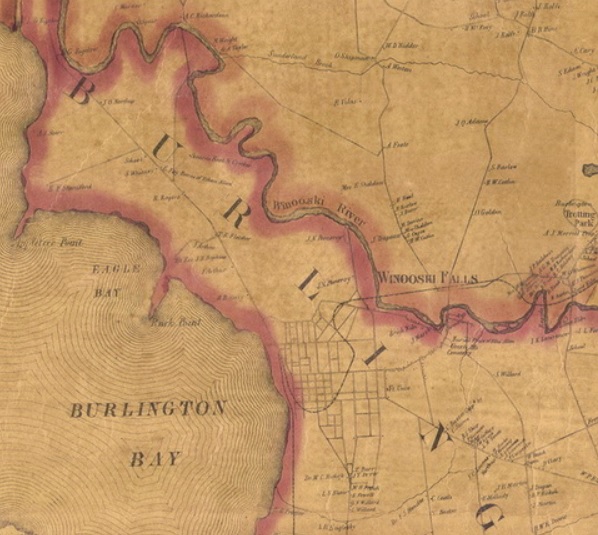
- comparing and contrasting historic maps with the modern map, or
- comparing historic photographs to the present landscape, and analyzing the changes.
Sample projects:
- Examining Champlain’s Maps and Drawings, a presentation for the Lake Champlain Maritime Museum’s Champlain Colloquium: Examining the Legacy of Samuel de Champlain in August 2019. I gave an illustrated talk for teachers about Champlain’s approach to cartography in the early 17th century, including the tools and techniques he used to map northeastern North America.
- Resources for Place-Based Classroom Lessons, a presentation with individual consulting time at UVM’s Special Collections Library for teachers in the Lake Champlain Basin Program’s Watershed for Every Classroom course. January 2019.
- Afterschool Program for the Curious!, at the Mountain River School in Stowe. A place-based science enrichment program investigating the school’s river, forest, and meadow areas. Children did hands-on activities to learn about how the local landscape transitions through the fall season. Fall 2018.
- Exploring the Life Stories of Gillett Pond Wildlife, for Twin Hills Girl Scout Day Camp. July 2018.
- Landscape History of Burlington’s New North End, at C.P. Smith Elementary School in Burlington. Presentation and teaching ideas for elementary teachers to use in the school-wide Place-Based Learning Initiative. February 2018.
- Green Mountain Club lesson plans for their Long Trail Bound Curriculum: The Mountain Effect, which looks at how the Green Mountains affect the weather of Vermont, and Mountain Building, which looks at the geologic processes that formed the Green Mountains. I also designed and led a workshop and field trip for the Long Trail Bound Summit program for teachers. October 2011 – August 2012.
