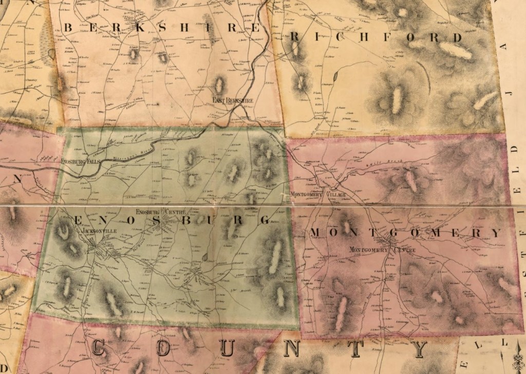
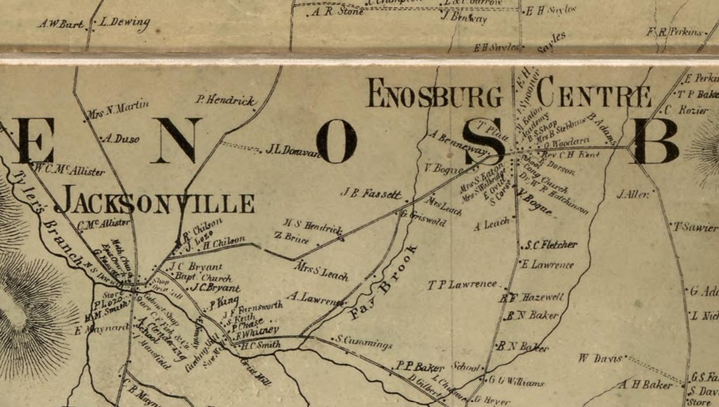
Some Franklin County towns, including Enosburg, in 1857 (by F.H. Walling, from the Library of Congress digital library)
I was recently interviewed by Erica Houskeeper, founder of Happy Vermont, about the patterns of Vermont towns and village names. She has produced a 30-minute podcast of our conversation called In Vermont, Why Are Things Where They Are? that can be found at: https://happyvermont.com/, on Spotify, or wherever you get your podcasts.
Two of Enosburg’s villages in 1857: Enosburg Centre village, established in the geographic center of town so it was accessible to all townspeople, and Jacksonville, a mill village in the town of Enosburg, that grew up around a water-power site on Tyler’s Branch. Operating mills included a saw mill, two grist mills (for grinding grain into flour), and a carding mill for preparing wool fleece for spinning. (F.H. Walling Map from the Library of Congress digital library)
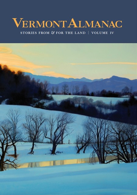
I was asked to be a contributor to the recently published Vermont Almanac: Stories From & For the Land, Volume IV. The Vermont Almanac is an annual publication organized by the month, and includes a year’s worth of stories and illustrations that celebrate our connections to the land. You can find my contribution in their August section on corn in the Vermont landscape. The Vermont Almanac, Volume IV is available at Vermont bookstores or can be ordered directly from: https://vermontalmanac.org/
Published by the Vermont Community Newspaper Group on June 9, 2023
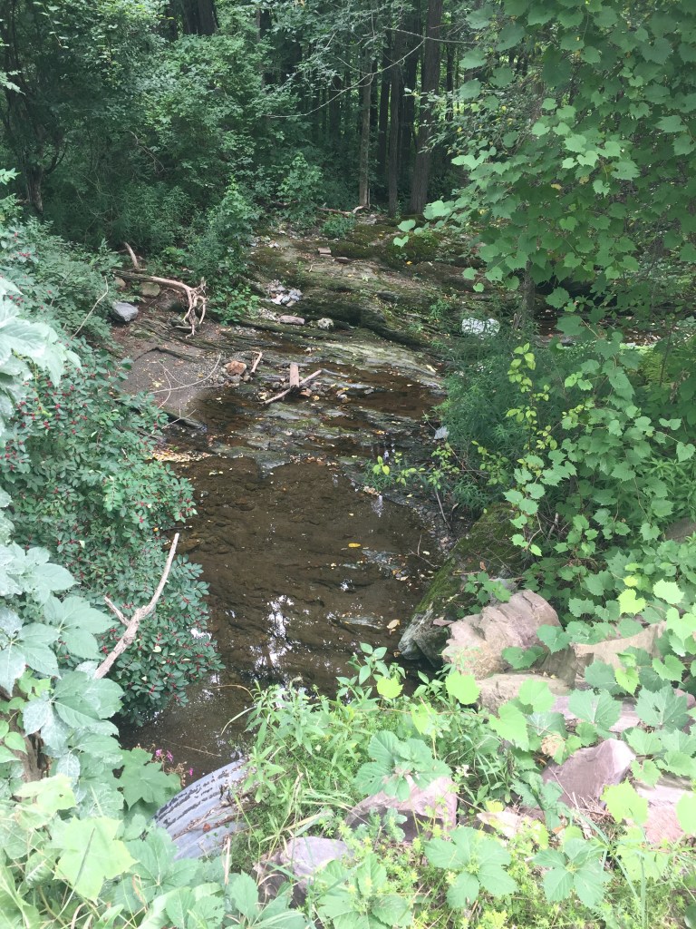
As soon as I opened my car door, I could hear rushing water. The sound drew me through the wooded ravine, getting louder and louder until I could finally see the water racing and tumbling down its rocky course. The brook drops 300 feet in elevation in a little over a mile, and the energy in the falling water had powered a string of mills that had operated for more than a century in this Chittenden County town. I had come to see what remained of those mills, and especially one in particular of a type I’d never seen before – an excelsior mill built in the 1870s.
Nineteenth-century stonework from old water-powered mills
As I stood at the top of the steep bank, I could see a long stretch of the valley below me crisscrossed with stonework. I tried to match what I was seeing on the ground to what my historic maps and photos were showing had once been there. Far upstream I could see a partially breached stone dam crossing the brook, and further downstream were the remains of two other dams. I was also able to match three rectangular stone foundations on one side of the brook with the sites of an old woolen mill, saw mill, and grist mill shown on an old map. These mills would have been kept humming by the local nineteenth-century farmers, as they brought their wool, logs, and grain in to be processed by the water-powered machinery in these buildings.
The excelsior mill had been downstream of the grist mill, below the third dam and just out of sight. I pushed through the trees and worked my way downstream, keeping my eyes peeled for any stone remnants. Near the bottom of the long cascades I spotted the rectangular stone foundation walls that matched the location, shape and size of the excelsior mill. Although the sound of the running water dominated the site now, I knew it had once been even louder with the machinery that had been working there.
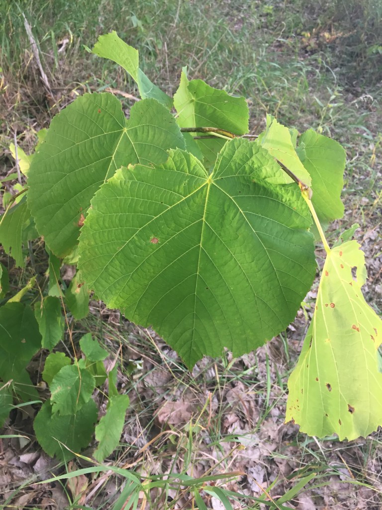
Excelsior is finely curled wood shavings that are soft when compressed but spring back when released. In the nineteenth century, these qualities meant it could be used for upholstery stuffing and mattresses, and for packaging and shipping (the equivalent of today’s foam rubber, packing peanuts, and bubble wrap). The highest quality excelsior was made of the soft wood of basswood and poplar trees, which are both native to Vermont.
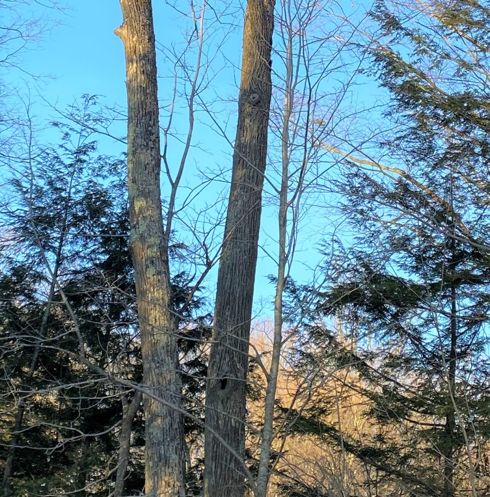
Two mature basswood trees before leaf-out in the spring
At its peak in the later 1800s, this mill was making 1000 pounds of excelsior per day. The multi-step process started with debarking and cutting the wood into short lengths, and splitting it into halves or quarters. The wood chunks were then fed into specialized shaving machines. The brook’s running water turned a waterwheel that ran the shaving tools to make the slender, curly slivers of wood. The final step for most excelsior mills was to bale the excelsior to make it easier to transport. Local historical accounts note that this mill’s excelsior was used primarily for mattresses and to line coffins made at a manufacturing plant in Bristol.
Basswood leaves are very large – often larger than a human hand
Having successfully explored the excelsior mill site, I started back to my car and turned my attention to the trees I was walking through. The ravine had many basswoods! Their very large, asymmetrical, heart-shaped leaves were unmistakable. Their flower buds were forming, and would open in the early summer. Their flowers are known for their strong fragrance and copious nectar, attracting many bees and giving the tree its alternative name: “bee tree.”
Many of the basswoods were very large – some two feet or more in diameter. The larger ones had holes in their trunks, since the heartwood of basswood trees rots easily. The hollows are often made by woodpeckers, and used as dens by squirrels, raccoons, porcupines, and owls.
Note that the basswood trunk on the right has several large holes which may be used by wildlife
As I walked past one basswood tree hollow, I saw a squirrel poke its head out of the hole. I thought how fitting it was that this site and this tree species that had made soft mattresses for people in the past were now making bedding places for small mammals.
Join me and Alicia Daniel, Executive Director the Vermont Master Naturalist Program, in a Biodiversity University course on Reading the Landscape of the Champlain Valley. The two-day course will provide you with a framework for an integrative approach to reading the landscape, including the bedrock, soils, plants, animals, and human land use history, and how they all interact.
Waterfall that once powered a cider mill in Richmond
I will lead a 3-hour session in Richmond on June 4 looking at the cultural landscape patterns and how they have interacted with the natural landscape through time. Alicia will do site visits that include the world-famous thrust fault in Burlington, a pitch pine forest in Colchester, and/or Raven Ridge in Monkton.
Local stone shaped into a grindstone that was used to grind hemlock bark at a 19th-century water-powered tannery in Richmond
This course is offered through the North Branch Nature Center for $285 (financial support available). For those interested, this course qualifies for 20 hours of professional development hours and continuing education credits.
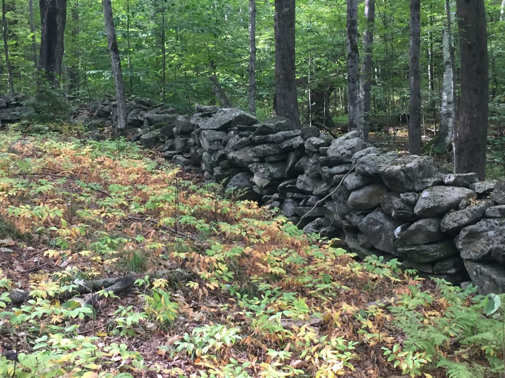
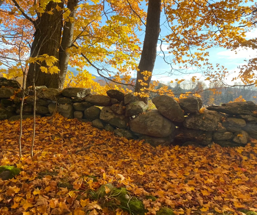
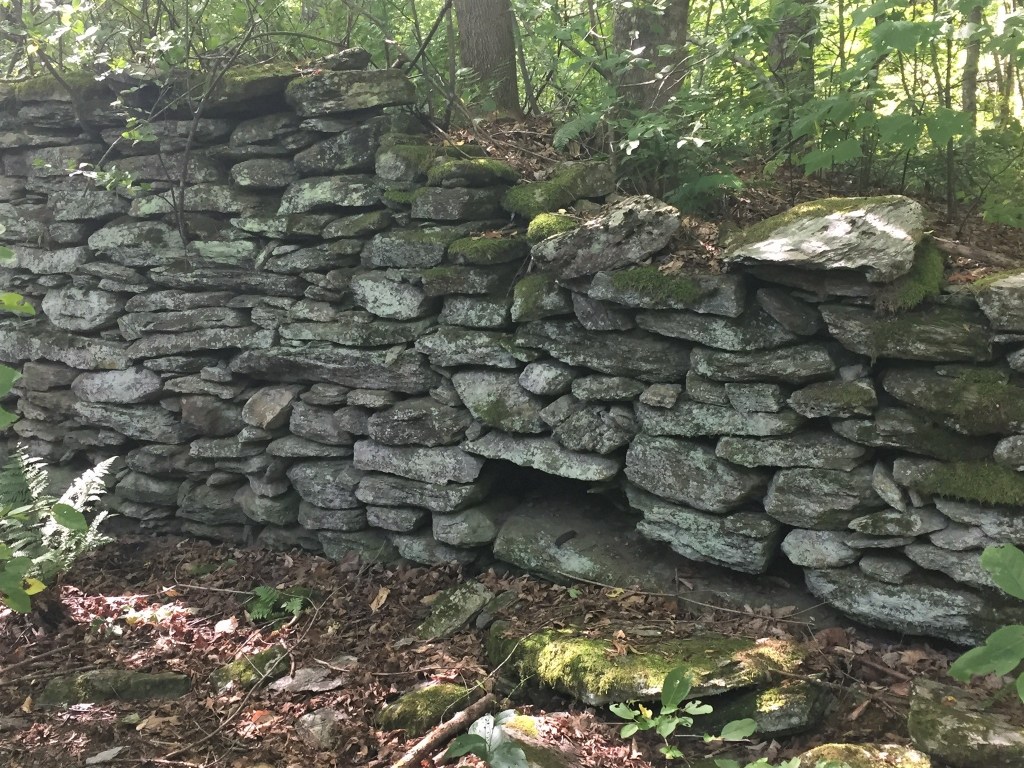
I was interviewed for a Brave Little State podcast that Vermont Public posted today. They were answering the question: Where did all Vermont’s stone walls come from? I shared some of my decades of research (starting with my master’s thesis: The Stone Wall Landscape of the Green Mountains) on how stone walls were built and their patterns in the landscape. Here’s the link: https://www.vermontpublic.org/podcast/brave-little-state/2023-04-13/where-did-all-vermonts-stone-walls-come-from
Published by the Vermont Community Newspaper Group in the Shelburne News and The Citizen, January 26, 2023
Bank barn foundation near a backcountry campsite in Little River State Park.
We were walking down a wooded trail in Little River State Park to see some old stonework that a friend had found near her backcountry campsite. Through the brush ahead, a six-foot-tall stone wall appeared, and as we got nearer we could see that it was a large, three-sided shape. It had all the features of a nineteenth-century bank barn foundation. When my friend asked why it was in the woods by itself, I said it probably wasn’t and we should look for the remains of the old farmhouse that had once gone with it. I suggested we look first on the other side of the trail, which looked like the old road. As we crossed the road and pushed through the brush there, the stone-lined cellar hole opened up in front of our feet, as I had predicted.
Cellar hole across the road from the barn foundation.
The pattern of building the farmhouse and the barn next to the road but across from each other was very common in western Vermont in the nineteenth century, and many examples remain today. In eastern Vermont, some farms followed this pattern and other farms connected all their farm buildings together (as in the children’s ditty “big house, little house, back house, barn”). Each pattern had advantages and disadvantages, and farm families had to weigh their choices before they decided how to build.
Nineteenth-century barn across the road from the nineteenth-century farmhouse.
With connected farm buildings, the farm family could walk from their house through the attached shed (or “back house”) to the barn without ever going outside, no matter the weather. The biggest benefit came in the winter when the frequent livestock feedings, milkings, and other farm chores could be done with much less exposure to the cold and wind.
Until well into the twentieth century, though, the farm chores were done by lantern light. The lanterns had open flames from the candle, oil, or kerosene they used, making them a fire hazard in the barns full of dry hay, straw, and other flammables. Farmers were careful about where they placed the lanterns, but there was always a risk of one being knocked over and starting a fire. If the barn caught on fire, it could easily spread to the other attached buildings, including the house.
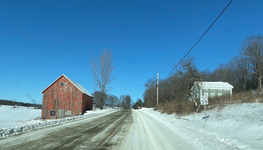
In western Vermont, most of the farm families decided they’d rather go out to the barn in all weather to lower the risk of fire spreading between buildings. They usually positioned their barns directly across the road from the house. This meant they were close by and easy to find in the dark, and the dirt roadway acted as a fire break preventing possible flames from spreading from one building to building.
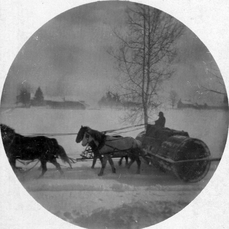
The roadbed was also easily traversed when going from the house to the barn, even in winter. In the earliest years, roadway snow was packed down using a variety of homegrown methods and devices. In the later nineteenth-century, towns used specially-designed snow rollers on the roadways to make a good surface for the main mode of winter transportation: horse-drawn sleighs. Farmers crossing the road from their house to the barn in winter would walk relatively easily on the packed snow surface.
Snow roller packing the snow on a rural road (before automobiles were used). From the Berlin Historical Society on the UVM Landscape Change Program website.
This pattern of placing the house and barn across the road from each other was usually possible because many early Vermont farms owned land on both sides of the road. The earliest farmhouses were built before the roads were laid out and the buildings were usually placed near the middle of their original lot, giving them easier access to their whole parcel. When the first rural roads were put in, they usually connected farm site to farm site in a neighborhood, thus running through the middle of the farm lots. Farm families, then, were able to put their farm buildings on both sides of the road and all of them would be on their property. This is very different from the placement pattern in the Midwestern U.S., where the rural roads were built on the lot lines between farms and the farm buildings would all be have to be on the same side of the road.
Where the roads became heavily traveled thoroughfares, farmers moved away from this pattern of building their barns across the road from the house so they could avoid crossing a busy road to do barn chores.
I always watch for this pattern when I’m driving on the back roads. But with most of the old barns no longer housing farm animals, it’s not an everyday sight to see someone crossing between the house and the barn as it would have in years past, especially not with a lantern in hand.
Published by the Vermont Community Newspaper Group in The Other Paper on November 23, 2022
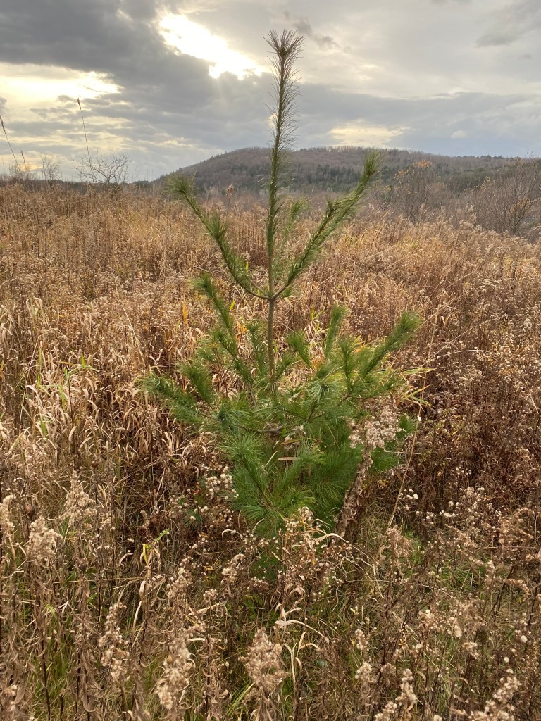
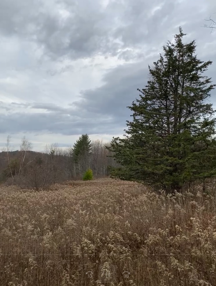
Young white pine tree getting started in an abandoned cow pasture.
“Look there,” the retired sheep farmer said as he slowed down and pointed to a ledgy, overgrown hillside. “That’s what I was talking about – see the white pines and junipers?” We were driving along a back road a number of years ago as he was telling me the story of his dairy farming neighbor’s struggles, and how I could read some of the chapters of that story in the plants.
In years past, he told me, the scrubby hillside had once been open pasture that the dairy farmer had run all his cows and heifers in. The animals had kept the grass and other greenery well grazed, except for the prickly-leaved plants they avoided, like white pine tree saplings and juniper shrubs. What the cows didn’t eat, the farmer clipped out every year or two so they wouldn’t shade out any of the valuable grass.
Juniper shrubs are very prickly so cows avoid eating them, and they survive in pastures if not clipped out.
But the dairy industry’s latest market pressures were pushing his neighbor to either size up or shut down his milking operation, and he finally decided to sell his cows. The pasture was empty. A second neighbor down the road, though, decided to size up and asked the farmer if he could lease the empty pasture for his heifers. The pasture was too far away from the other neighbor’s barn to walk the milking cows back and forth twice a day for milking, but the heifers that were too young to be milked could graze there without much trouble. The second neighbor would then be able to increase the number of milking cows on his own pasture once his heifers were moved.
The first neighbor agreed, and the heifers were brought down the road and happily grazed in the pasture that summer. Over the following years, the heifers continued to graze the grasses, although there were fewer of them than the cows that had been there previously. With no more pressure to maximize the grazing area, the regular clipping of the prickly-needled saplings ended.
Now that the pasture was undergrazed, the prickly tree and shrub seedlings got well established. The time came when the second neighbor decided to shut down, too, and the pasture no longer had any grazing farm animals. But the white pine trees the heifers hadn’t eaten had a head start on the other plants that started coming in as the pasture transitioned toward forest.
This white pine tree got a head start on the other trees seeding in to an undergrazed pasture that was later abandoned.
After the sheep farmer clued me into this landscape history story, I started to look for this pattern in my other research projects. Where I could, I watched for pastures that were still being used, those being undergrazed, and those recently abandoned, and looked at the kinds of trees that were first coming in and their relative ages. At sites further along in their forest regrowth, I looked at aerial photos I could find from decades past to reconstruct the stages of their landscape histories.
I noticed that not all abandoned pastures went through an undergrazing stage, but those that did showed this pattern repeatedly: in the undergrazed pasture situations, the prickly white pines, especially, stood out above the goldenrod and other early meadow plants. The head start the white pines had over the poplars, birches and other early species that came in after grazing stopped is visible even many decades later. In the areas of the Champlain Valley with limy soils, red cedar trees were the ones getting the head start. The large white pines and the red cedar trees then became good clues for me to watch for.
Red cedar in the foreground and white pine in the distance in an abandoned pasture.
With this new focus, I also began to notice that other farmland uses, such as old corn fields and hay fields, often had somewhat different reforesting patterns than the old pastures. When I tuned into the subtler differences, I found I could also use those forest patterns as clues to reconstruct a more detailed history of the past farm land use on research sites.
With 80% of the Vermont landscape having been cleared of forest in the late 1800s, and a significant percentage of that open land in pasture, there are lots of places where the pasture abandonment stories have played out. In Vermont, we are currently losing pasture land at a higher rate than other land uses. As dairy farming is transitioning to feeding cows inside year round now rather than pasturing them, the next chapter in pasture abandonment is being written.
During stick season, I find myself looking for the green foliage of the white pine trees and red cedars standing out against the mostly brown forests, and look for other signs of abandoned pasturing. When I find them, I also think about the generations of dairy farmers who’ve made difficult decisions about their land that can be read in patterns on the landscape decades later.
Published by the Vermont Community Newspaper Group in The Shelburne News and The Other Paper, 10/6/22
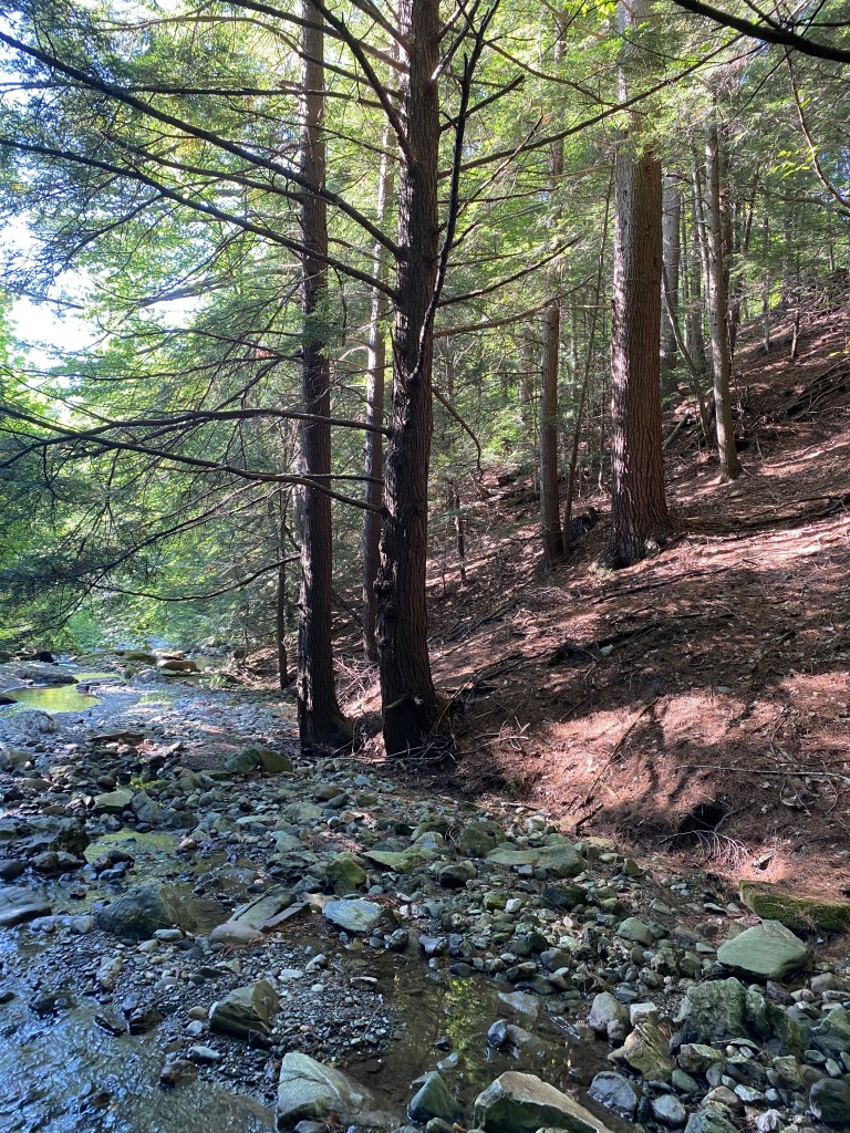
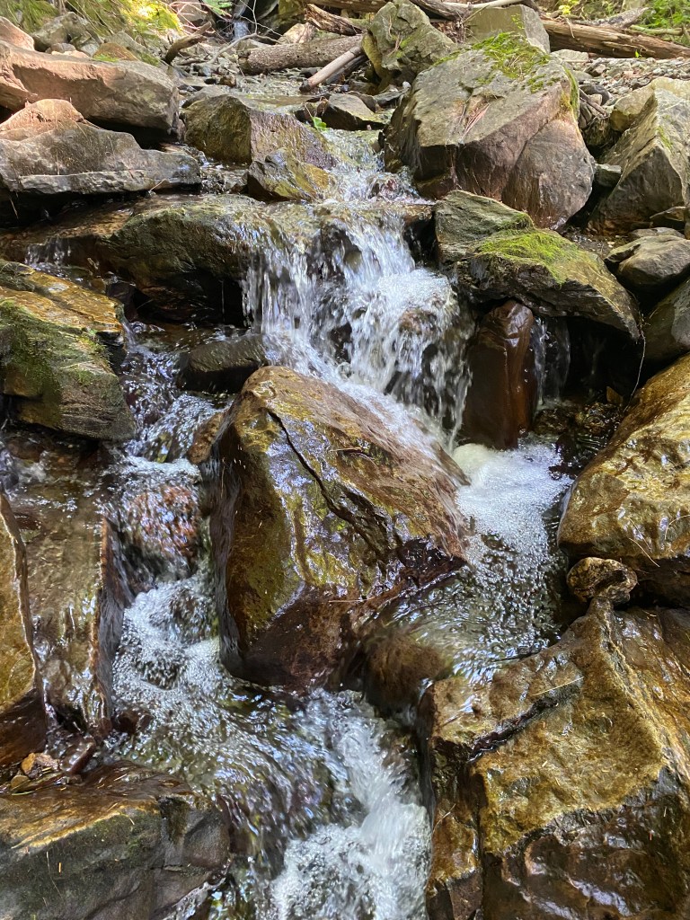
How fitting to be surrounded by hemlocks, I thought as I scrambled down the steep bank of the brook. Hemlocks were one of the key elements in the 19th-century mill I was exploring and here were some of their descendants as witnesses. Would I find any remnants of the old dam or the foundation of the water-powered bark mill? I continued downslope to see.
The old bark mill was part of the local tannery that operated from the early 1800s to the 1880s processing animal hides into leather. After the saw mills and grist mills creating materials for shelter and basic foodstuffs, the tanneries were the next most important local industry supporting early European settlers. Without shoes and boots for people, or harnesses and saddles for horses, farming life would have been very difficult in the era before plastics, rubber, and gas-powered vehicles.
Transforming animal skin into leather was a skilled, labor-intensive, multi-step process that used a sequence of salt, lime, and tannin treatments with large amounts of water. Tannins are natural chemicals produced by many plants to deter pests (they also give coffee and tea their color and astringency). Tannins in a water solution will chemically bind to the animal skin proteins and alter them to keep them from decaying. Tannins also make the skins more durable, water and heat resistant, and flexible. Hemlocks have large amounts of tannin in their bark, and are common in Vermont, so tanners here used them extensively. The hemlock bark needed to be ground to a powder so the tannins would easily dissolve in water.
The tannery site I was looking for was on several 19th-century maps, and had all the key environmental features together in one place. To produce the power needed, it was built below a steep section of brook created by a geologic fault line. The tanner built a dam to impound the flowing water and regulate its flow to the bark mill. The water power turned the bark mill’s grindstones to grind the bark into powder, much like a grist mill’s grindstones grind wheat seeds into flour. Of Vermont’s 126 bark mills in 1850, three-quarters were water-powered, with most of the rest horse-powered. The brook’s steady flow of water was also essential to processing hides because many of the steps required chemical solutions soaking in large vats, and rinsing with large amounts of water.
Tanners gathered the materials they needed locally. Farmers brought hides in from their livestock, often paying the tanner with a portion of the hides. Wood lot owners provided hemlock bark, and lime came from the limestone quarries common in the Champlain Valley.
The tanner’s process began by salting the skins to stop bacterial growth, then rinsing the salt out with water. This was followed by soaking the hides in a lime solution to remove the hair and any fats left, then de-liming them with either water or a vinegar solution. Finally, the hides were put to soak in a series of water vats with increasing concentrations of dissolved tannins. Hides were moved from vat to vat as determined by the skill of the craftsman over many months to become fully cured leather. The tanning process was known to be very smelly, and the waste was usually disposed of in the brook.
Cobblers and harness shops bought most of the finished leather. In the end, the community was shod and had the harnesses for horse-drawn farm work.
Later in the 19th century, bark tanning was eventually displaced by a synthetic tanning process using chromium salts, which took only hours to produce finished leather instead of months. Bark tanneries eventually closed.
I looked around the site to see what was left of the 19th-century mill works. Upstream, I could see the remnants of a grist mill and saw mill, but there was little evidence left at the tannery site. Some stonework seemed to line up on both sides of the brook, but it was heavily damaged. Probably the floods through the narrow valley over decades had flushed much of it out, leaving me to imagine the rest from the descriptions.
It was time for me to head back up the steep ravine, and I steadied my ascent by holding onto the 2-foot diameter hemlock trunks. I paused for a moment to catch my breath, and because the hemlocks’ dense shade keeps out understory growth, I was able to review the valley below. All the pieces had come together here: the geology of the steep ravine creating the opportunity for power, and the rushing water to drive the bark mill, to soak the hides, and take away the refuse. But without the gray, platy hemlock bark under my hands, none of this would have been possible.
Published by the Vermont Community Newspaper Group in The Citizen on 7/28/22
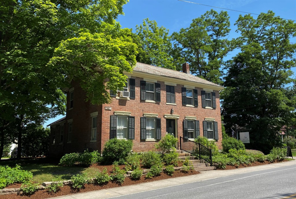
Handmade brick house built in 1815 in Shelburne
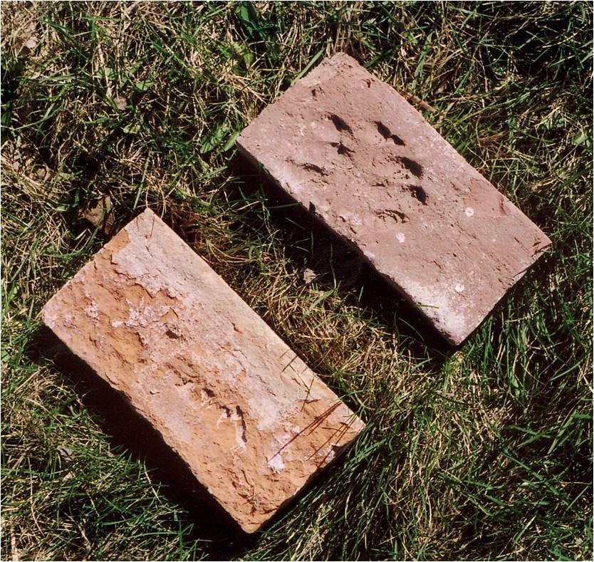
When the invitation came to visit an old brick farmhouse nearby, I jumped at the chance. The owners walked us around their home and passed along its stories. One wall section had been removed because of water damage, and the bricks had been saved in a shed out back. Looking through the old bricks, I could see they were basically the same size, shape, and heft as modern bricks, but no two bricks were exactly alike. When I found one with finger impressions baked in, I knew they were truly handmade. Once I delved into the bricks’ stories, I also found that they were deeply knit into the story of the landscape.
Handmade bricks, one showing the fingerprints of the brick maker
The bricks dated to the early 1800s and were made of local clay from a low area just down the road, now a cornfield. I visited the site, and could feel the clay’s plasticity while kneading some soil in my hands. To one side was a square-sided pit where some of the clay had been harvested. The kiln had also been nearby, and the small brick fragments scattered through the cornfield were its tangible evidence more than 150 years later.
In that era, bricks were made by hand using wooden molds. The clay was laboriously mixed and kneaded, then hand-pressed into molds and the excess scraped off with a flat, wet stick. They were then knocked out of the molds and set to dry for days. They were turned regularly to promote even drying and discourage bending. Once dry, they were built into a kiln shape and wood-fired in a carefully monitored process. When finished, the best ones were used for house exteriors, and the others in less critical areas.
The bricks in the shed were idiosyncratic. Some had small embedded pebbles, not unlike the cornfield’s soil. Some had pitted surfaces, or were curved, probably from the molding and drying process. Some had shallow, parallel grooves along the tops, probably from the wet stick scraping off the excess clay. The fingerprints were from handling it while still wet. These brick details were witnesses to the many hands and multiple steps involved in their creation.
Each brick weighed 4-5 lbs, and with the thousands needed to build a house, the total weight of bricks moved from kiln to house site was measured in tons. In these pre-railroad days, newly finished bricks traveled by horse- or oxen-drawn wagon to house sites. It’s not surprising that most were built very near the clay source.
After this visit, I watched for old brick houses in my journeys, and read any stories I could find. Many Champlain Valley towns have 10-20 brick farmhouses from this era, and there are many mentions of using local clay from near the house site.
After mapping them, I noticed that most of the old brick houses are at 600’ in elevation or below. We have the glaciers to thank for this. Not only did the glaciers generate huge volumes of clay (and other) particles as they scraped over rock faces, they also moved huge quantities of these particles in their meltwater.
In the last glacial stages 13,500 years ago, Glacial Lake Vermont was formed when an ice dam plugged the Champlain Valley’s northern end. The ice dam held back the melted glacial water that normally drained north, and filled the basin to about 600’ in elevation for about 1500 years. All of Lake Vermont’s tributaries brought meltwater filled with sediments from the glacier-scraped hillsides.
Glacial Lake Vermont (in blue) filled the Champlain Valley to about 600′ in elevation
After the ice dam failed, the lake level dropped, and was partly replaced by salt water flooding in to about 300’ in elevation. The Champlain Sea, as it was called, lasted 2000 years, and very heavy clay deposits accumulated during its time. The Champlain Valley below 600’, then, has mostly clay-rich soils dating to these two different stages of the glacier’s melting.
The valley’s glacial history set the stage for the old brick houses, but it also brought other related landscape features. Because the clay makes very rich farming soil, farms were established early and are still very productive. With few stones in the soil, no stone walls were built around the fields. Instead, early farmers brought in non-native black locust trees to use for fencing (see my CTD column, January 2021), and many of the old brick farmhouses have black locust trees nearby. The lack of stone walls has also made it easier to consolidate farm fields from the early 5-10 acres to the much larger sizes today. These features work together to make a distinctive clay valley farming landscape, anchored by the brick houses.
Now, every handmade brick house I see reminds me of the warm hands that shaped the clay into brick, as well as the ice-cold water that deposited that clay.
Published by the Vermont Community Newspaper Group in The Other Paper on 5/19/22.
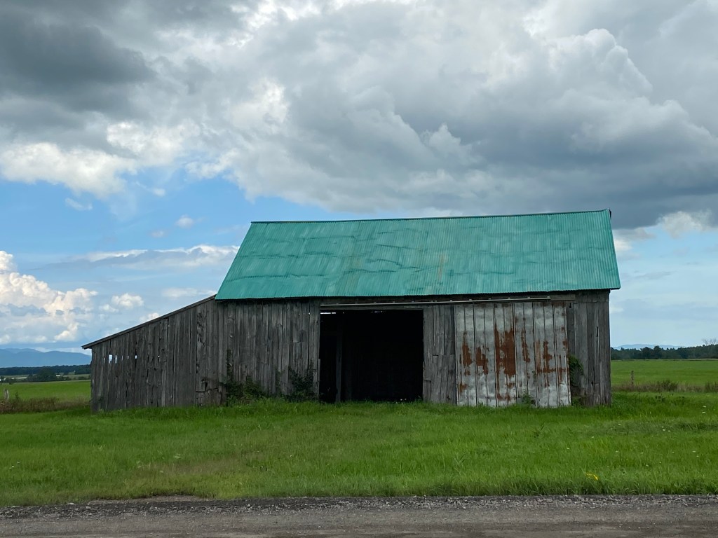
30X40 style barn with a shed attached on the left
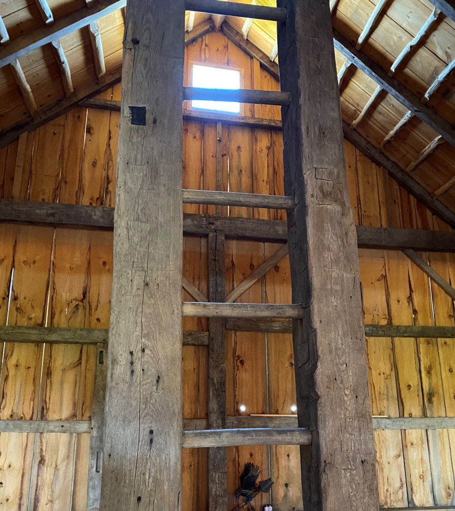
As I walked into the rebuilt 1790s barn, I paced it off and found it was 30’ by 40’, just as I expected. Barns that age are usually English style barns, also called “30x40s” because of their standard size. They were often the first barns built on early subsistence farms here, and had been built in England since the 1600s. I was preparing a field trip about this farm’s evolution for some UVM graduate students, and I decided I’d use this barn as a key piece in describing Vermont’s transition from mostly forests to mostly farms.
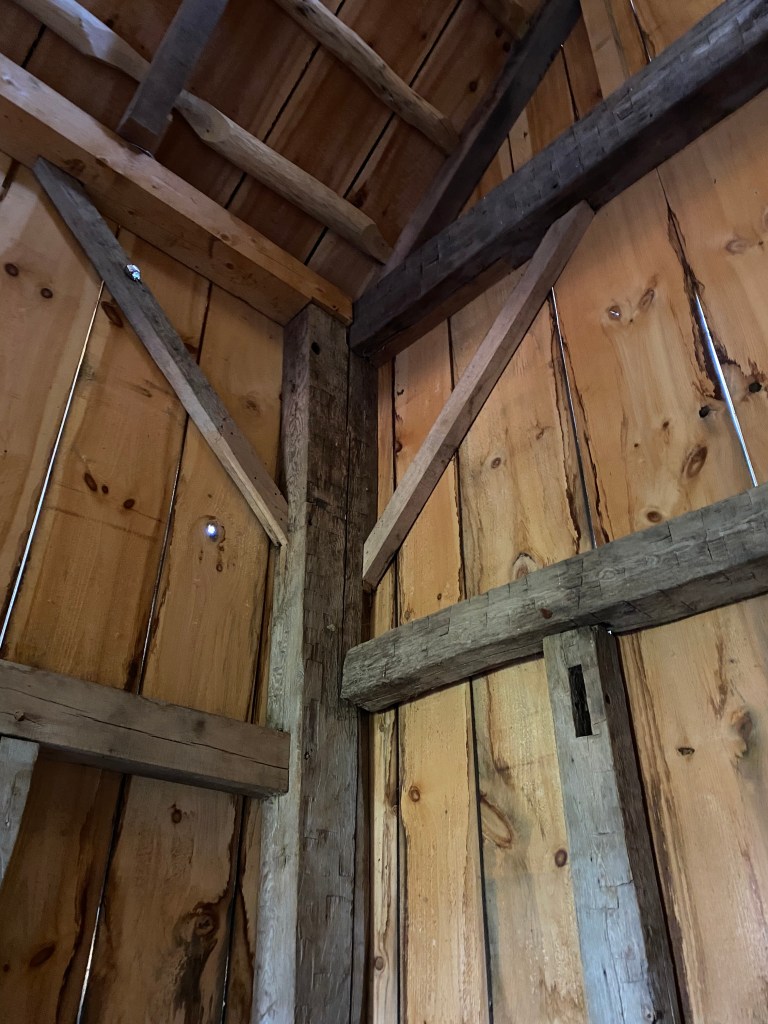
The old barn had recently blown down in a wind storm and had been rebuilt using some of the original pieces by Eliot Lothrop’s restoration company Building Heritage. I wasn’t surprised that the pieces that survived were the wooden posts and beams. The internal frame was hefty, with some of the timbers 10-11” square in cross-section. Most were beech, with a little ash and oak. Because the timbers were hand hewn, the original trees had almost certainly been rooted within a stone’s throw of this spot. This farm lot had been completely forested when the settlers arrived, and it seems fitting that most of the barn’s timbers were from the most common tree: beech was 40% of this pre-settlement forest.
The transition from tree trunks into framing timbers can be read in the marks on the wood. After the standing trees were felled, shaping was done with an ax in two steps. The first marks were made across the grain, scoring the tree trunk to the proper depth for the finished timber. The next marks were made along the grain where the ax hewed out the wood between the scored marks, creating the flat face. Finally, the mortise and tenon joints were shaped with hand tools, then pinned with wooden pegs.
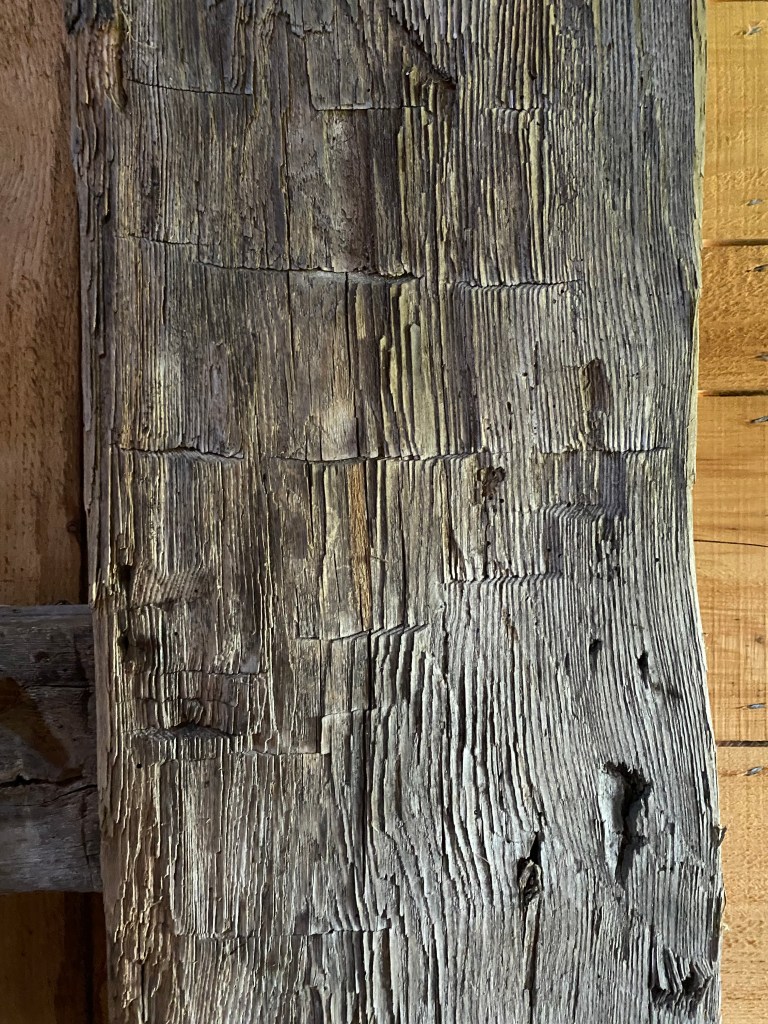
Hand hewn post
The 30×40 barn was usually the farms’ largest building, providing shelter for animals and harvested crops. Their typical layout was in three sections or bays that served the farm’s multiple needs.
The barn’s main doors opened onto the center bay which was the threshing floor, a feature later Vermont barns don’t have. Early farmers cleared a few acres around their house and barn to grow grain crops, especially wheat and oats, for themselves and their animals. In the fall, they were harvested, dried in the field, then brought into the barn to be threshed and/or stored. For threshing, the farmers spread the grain stalks on the wooden floor and hit them repeatedly with handheld flails, separating the seeds from the stems and husks. Then, by tossing the mixed grain and chaff into the cross drafts from doors on either side of the barn, they separated the heavier grain from the lighter husks. Sometimes, farmers stood a board across the bottom of the doorway to hold in the grain being threshed – giving us the word “threshold.”
Grain not threshed immediately was stored in the loft over the threshing floor, accessed by a central wooden ladder. Once threshing machines were adopted by the 1830s, threshing floors no longer felt the repeated hits of the flails.
Wooden ladder to the loft over the threshing floor
The barn’s main doors were a little off center, creating a smaller bay on one side and a larger one on the other. The smaller bay was usually for the livestock that could probably be counted on one hand. The larger bay was for hay storage. Hay was grown in small fields nearby, harvested with hand tools, dried in the field, forked into a wagon, driven into the barn’s center bay, then forked into this large bay for winter animal feed.
Including the hay and crop fields, a typical 100-acre subsistence farm had cleared about 10 acres by 1815, and most of those acres’ products flowed in and out of the barn with the seasons.
Later in the 1800s as Vermont shifted into commercial farming with more livestock, the 30×40 barns were often adapted. Some were moved onto banks to add a lower floor, were lengthened, or had a newer, larger barn attached to it for housing more animals and winter feed. As dairy herds increased into the 20th and 21st centuries, the new dairy barns built for many hundreds of cows dwarfed the original 30x40s.
But many of the 30×40 barns remain on our landscape as witnesses to an ever-evolving landscape. In our area, most of the 30x40s built before 1830 were framed with beech from the pre-settlement forest, preserving that wood as much as 230 years later. Like those in the 1790 barn I visited, the wooden beams had gone from being separate, tall trees anchoring the forest to becoming shaped timbers pegged together at many different angles, working as one unit to anchor the early farms.
Copyright 2022 Jane Dorney
My thanks to Eliot Lothrop of Building Heritage for sharing information from his rebuilding of 30X40 barns.