Published by the Vermont Community Newspaper Group in The Citizen on 3/31/22, and The Other Paper and Shelburne News on 4/7/22
Q: How can we see corn’s impact on the Vermont landscape through time?
A: A retired farmer I once interviewed told me that on Groundhog’s Day – winter’s halfway point – he always checked to see if he still had half of the feed his livestock needed to make it to spring. I think of him in late winter as I drive past farms and look at their remaining silage. And as I do, it reminds me how the corn plant, originally a wild grass from Mexico, has changed Vermont over time. Many of the story’s chapters can be seen today.
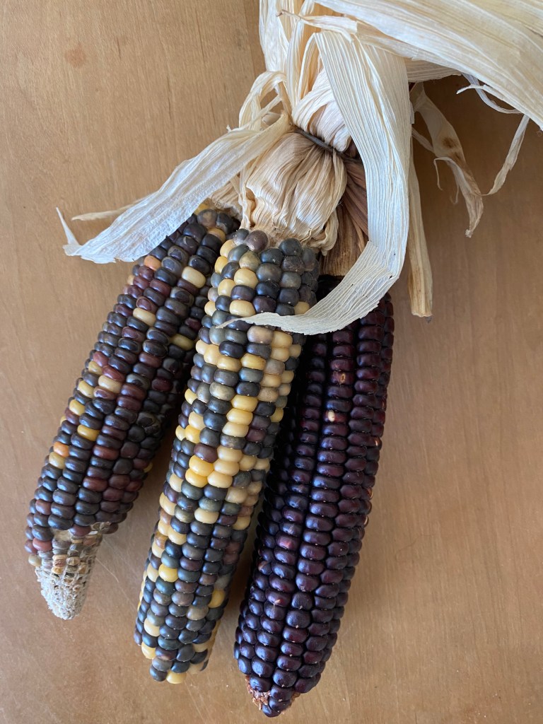
Today’s corn is descended from a southern Mexican grass called teosinte with cobs 1/10 the size of modern corn. About 9000 years ago, Native Americans started selectively breeding teosinte for larger seeds using hand pollination and hybridization. By the time Europeans arrived in the late 1400s, corn had been shared by Native Americans from group to group across both American continents. They had bred many different varieties to grow in a wide range of temperatures and rainfall, including Southwestern deserts, Canada’s cold areas, high-elevation Andes, Amazon rainforests, and many places in between.
New England settlers learned to grow corn from Native Americans. Corn’s climate adaptability made it a good addition to the wheat, oats, barley, and rye settlers had brought with them from Europe. Farm animals, including cows, pigs, sheep, and chickens, happily ate corn, allowing settlers to add more protein to their diets with more milk products, eggs, and meat.
By 1850, corn was the second most common grain produced on Vermont farms, with more than 2 million bushels grown annually. Only oats for horses edged it out in production. Corn was harvested when the kernels were dry, husked by hand, and stored in specially designed corn cribs raised on posts to keep rodents out (the Rokeby Museum in Ferrisburgh has one).
In the 19th century, the Germans started experimenting with fermenting chopped green plants into silage using the same process used for sauerkraut. The still-green plants were harvested, chopped, compacted to exclude air, and left to ferment for several weeks. The silage was so acidic it preserved itself for months with little spoilage.
After these successful experiments, New England farmers started making corn silage in the late 1800s. It had a dramatic impact, particularly on dairy farming. Silage was more digestible and palatable than kernel corn for cows, and feeding the whole plant (not just the kernels) provided much more food value per acre of corn. The higher quality feed could also be available all winter, significantly boosting milk production by milking year-round.

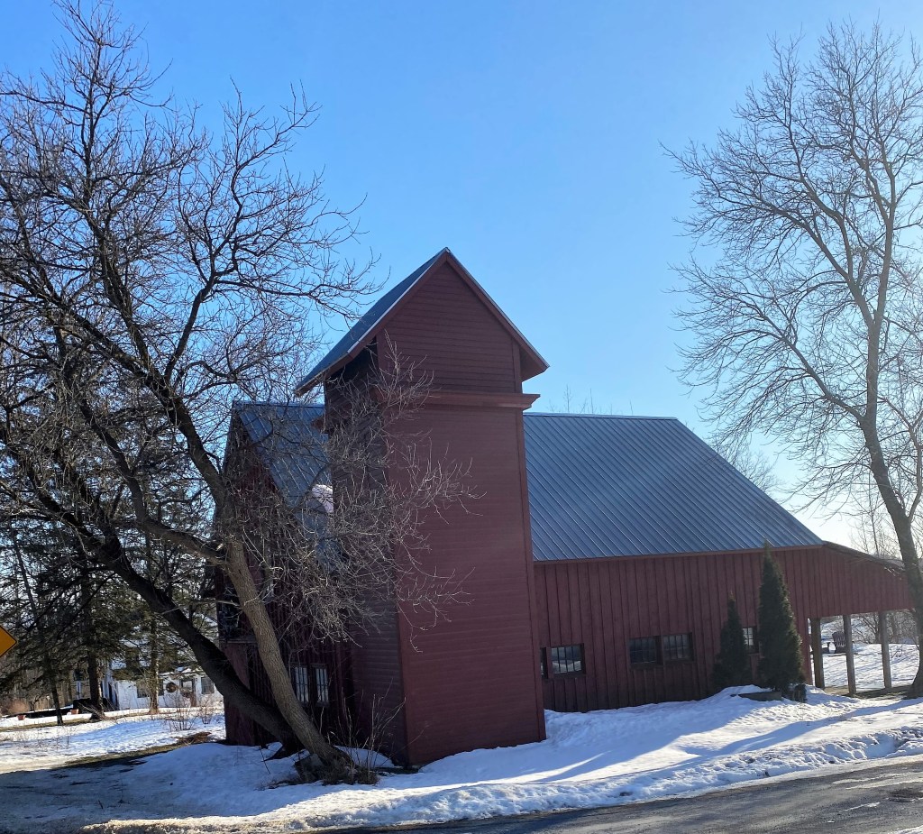
As local farmers continued to experiment, their silage storage methods evolved. At first, a few adventuresome farmers built underground pit silos. When it proved too hard to lift the silage out, farmers tried above-ground wooden silo rooms built in a barn corner or separate structures outside the barns. Unfortunately, the silage in the corners of these square spaces spoiled. By the early 20th century, farmers tried 8-or-more-sided wooden towers, some of which can still be seen today.
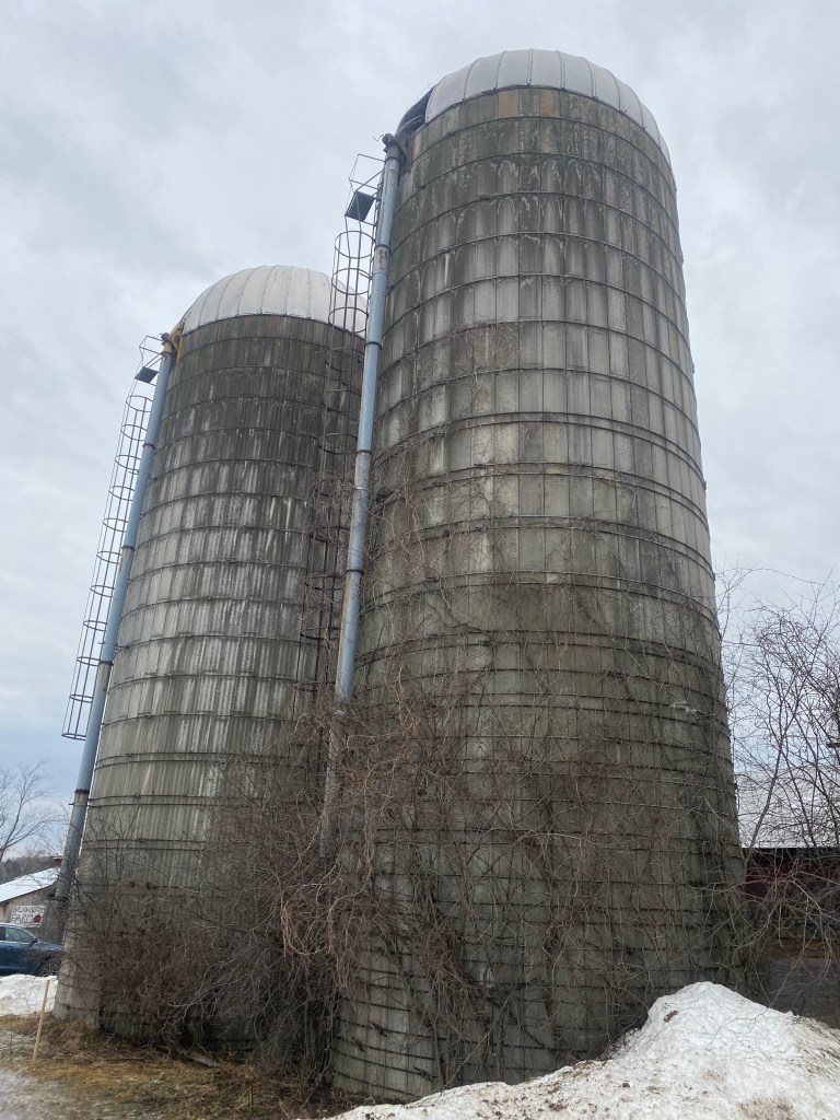
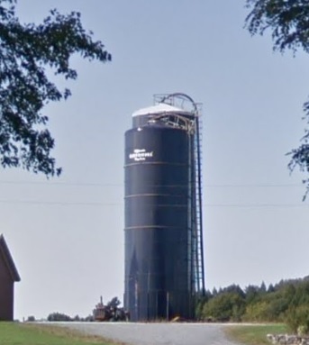
As the average farm herd increased tenfold from the late 1800s to the late 1900s, the need for silage increased. Concrete became cheaper and farmers began building round concrete silos, still considered the classic by many. But the most modern silos are the large blue metal Harvestores that are virtually airtight and better preserve silage.
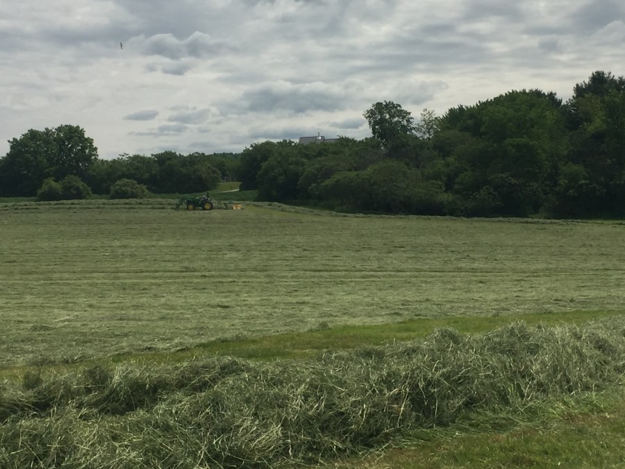
In recent years, many Vermont dairy farmers have moved away from using upright silos and use 3-sided concrete bunkers instead. Silage is loaded in the bunkers, compacted by driving heavy equipment over it, and covered with plastic sheets weighed with tires to ferment. In 2020, Vermont farmers grew 80,000 acres of corn at 19 tons/acre. Much of it was stored in silage bunkers.
While farmers are still innovating with new corn varieties and silage, some local groups are preserving Indigenous seed varieties saved for centuries by Native Americans. In 2012, the Seeds of Renewal project sought out Abenaki-saved seeds in the region and established a seed library with Sterling College. Recently, the nonprofit Abenaki Helping Abenaki has partnered with Vermont farmers and gardeners to use some of the surplus Indigenous seed to grow food and distribute it to Abenaki citizens.
Corn changed Vermont, the Americas, and the world. Developed by Native Americans over thousands of years, corn is now the world’s number one grain crop. It’s raised on every continent except Antarctica and feeds billions. We can see our story’s chapters in the silos and the silage bunkers along our rural roads. The silage may be over half gone, but our dairy farmers are planning the next growing season and will soon be planting corn again, as the cycle continues.
Copyright 2022 Jane Dorney