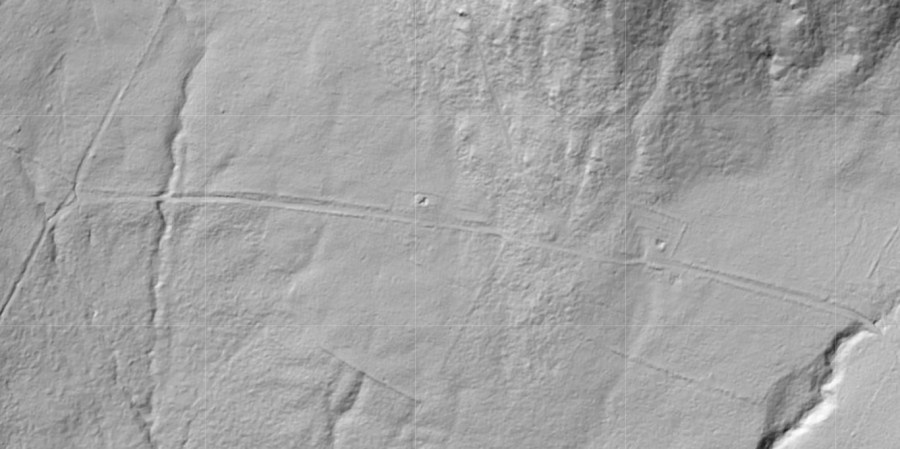
I gave a presentation in October at the League of Local Historical Societies and Museums Annual Meeting in Woodstock, VT entitled: Using LiDAR to Find and Interpret 19th Century Features. LiDAR is a new mapping technique that uses pulses of laser light to create 3-D images of the landscape. It can “see through” the trees to show the shape of the ground underneath. Cultural landscape features, such as stone walls, that are now deep in the woods and not visible with conventional aerial photographs can often be seen with LiDAR. This new imagery is dramatically changing some aspects of archaeological and historical research.
For my presentation, I used a series of “detective stories” from my field work this summer and fall where I was looking for abandoned 19th century features with LiDAR images and following that up with field work for ground checking. I walked the local historical society members in the audience through the steps of learning how to use LiDAR to find cellar holes, stone walls, mill foundations, barn foundations, and old roads. I also included cautions and examples of some of the limitations of the imagery. In the end, I encouraged people to try out this new tool. I am a new fan, and will be using it constantly in my work to save time, and to find things I might not be able to locate otherwise. I hope others will try using it, too.
If you’d like to look for yourself, Vermont LiDAR imagery is available here from the Vermont Center for Geographic Information.
